
Garden Map Co-ordinate Trail
Garden Map Co-ordinate Trail
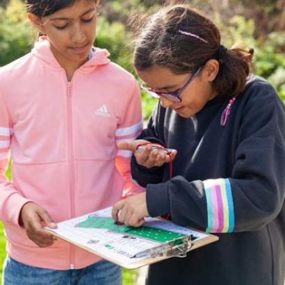
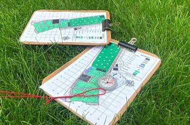
In the classroom we will look through the different features of maps including symbols, scales, orientation and co-ordinates. Working in pairs, pupils will use a map and compass to find features within the grounds using co-ordinates.
Learning objectives
- To understand that a map is a birds eye view of a place at a smaller scale.
- To recognise different features on a map using the symbols and begin to relate what is shown on the map to what they can see.
- Use simple coordinates (or four-figure grid references) to locate points (or areas) on a map.
National geography curriculum links
KS2
Geographical skills and fieldwork
- Use maps to locate countries and describe features studied.
- Use the eight points of a compass, four and six-figure grid references, symbols and key to build their knowledge of the United Kingdom and the wider world.
National mathematics curriculum links
Y3
Geometry - properties of shapes
- Identify horizontal and vertical lines.
Y4
Geometry - position and direction
- Describe positions on a 2-D grid as coordinates in the first quadrant.
- Describe movements between positions as translations of a given unit to the left/right and up/down.
- Plot specified points and draw sides to complete a given polygon.
PSHE guidance
- To equip pupils with a sound understanding of risk and with the knowledge and skills necessary to make safe and informed decisions.